After three months at sea, it was time for a road trip and
another Delvy adventure. It was a relief to be on terra firma for a break: it
didn’t take long at all to find our land legs. Travelling in the motorhome is very
easy compared to the challenges of a large sailing vessel so we were happy to
take a long drive north over a short space of time for a change of scenery and
to catch up with friends.
Our first overnight stop was at the privately owned Donnington Airpark south of Townsville, where friends flew or drove in for a weekend get together. We were each lucky to get a dawn aerial view of the campsite and the Bowling Green Bay National Park ridgeline poking through the fog enveloped flat land below. As the fog lifted with the increasing light, I caught a glimpse of the region’s potable water supply, Lake Ross, before coming into land on the browned airstrip.
 |
| Camping with friends |
 |
| So many tracks criss crossing below |
After a hearty cooked breakfast, it was time to hit the road. Next stop, Yorkeys Knob. Google Maps says it’s 400km and 5 hours driving away. In Delvy, that means 8 hours driving at least: a full day for us as we average about 90 kilometres an hour. This is northern Australia, and if you want to get anywhere, you have to drive for a very long time. We don’t mind though as we can stop where we like and relax in our own self-sufficiency: except for diesel fuel of course, which, fortuitously, is fairly cheap at the moment. We’ve travelled this part of the Bruce Highway (the Sugarcane Way as we like to call it), several times, and have already explored most of the attractions along the way so we were content to just drive and enjoy each other’s company.
 |
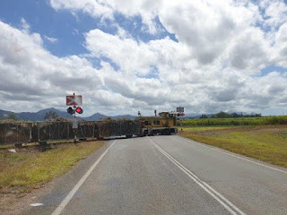
| We had our cane train brains switched on, just like the song asks |
 |
| Wooroonooroon National Park |
Our long-time friends and the smell of a lamb roast dinner greeted us on arrival north of Cairns, and a rainy walk around the township and boardwalk highlighted we were in a different world. So many tall, lush tropical plants – a contrast to the dry tropics of the central Queensland coast.
We can’t seem to stay away from boats so took the opportunity to catch up with people we met at Christmas in Newcastle – his mother lives opposite my mother – who are living on board a 42-foot catamaran in Bluewater Marina. After an extended cuppa, it was time to head home, choosing to go up the range on the Kennedy Highway via the Atherton Tablelands. With COVID-19 restrictions, Cairns and the surrounding areas are very quiet on the tourist front: attractions are only open on weekends so it will have to be another time to experience the Skyrail Rainforest Cableway, amongst other things.
 |
| This marina in usually busy with visiting cruise ship passengers - all quiet now. Bluewater Marina is around the next headland. |
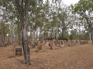
Lunch was at Rocky Creek War Memorial Park on the site of the largest WW2 military hospital in the Southern Hemisphere, where approximately 60,000 Australian soldiers were treated and rehabilitated by about 2,000 staff. Set amongst the dry open woodland, you can wander around the memorial stones of those who served, and view the interpretive signs explaining the layout and function of this extensive area.
 |
| Beautifully restored quonset hut originally used to host entertainment and gatherings for troops stationed on the Atherton Tablelands |
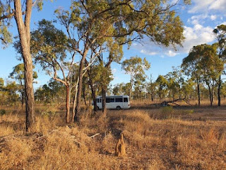
Climbing to 1162 metres, the highest road in Queensland took us towards Ravenshoe, the highest town, and down the other side of the Great Dividing Range into cattle country. Traffic was very light, and as the afternoon sun dropped it was time to look for a campsite. The beauty of the Australian outback and being in the middle of nowhere is that you can camp anywhere on the side of the road. Provided you don’t park across an access gate or track, the world is your oyster. Passing traffic reduced to zero from sunset to sunrise, and with only bird noise breaking the silence it was a blissful night’s sleep in the Aussie bush.
 |
| There are termite mounds aplenty, ranging from large red igloo shapes to beige spindly ones like this. |
 |
| As well as an array of different native wildlife, pieces of cotton balls line the highway for miles and miles. Very strange. |
Leaving National Highway 1, we turned onto the Great Inland Way and headed for the first available fuel. Back in January 2017 we travelled this 3000 km tourist road from Clermont to western NSW. After filling up at Greenvale Roadhouse, we took a quick spin around the 1 km² village, which revealed the main attraction as a fine example of a sausage tree. Taking turns at driving and stopping at the countless roadworks, we reached the popular and enormous Fletchers Creek camp area, a stone’s throw from the Burdekin River and Dalrymple National Park. Without our e-bikes, our explorations were minimal, but reading some of the history was interesting. Ludwig Leichhardt camped near here on his 1844 expedition from the Darling Downs to Darwin, and several hundred school children also camped beside the river for 18 months during WW2 as their school in Charters Towers, 55 kilometres away, was acquisitioned by the Commonwealth and used as a military hospital.
Moving on and more fuel later, we took the turn off to Ravenswood, a gold mining town since 1868 with several beautiful historic buildings. After a town wander, we acknowledged the warning sign, “No caravans and buses”, and drove the 90 km part gravel road down to Ayr, admiring the marvellous views of the valley below. Having come full circle, we again crossed the impressive Burdekin River Bridge near the river mouth, which is nearly 800 kms from its source.
 |
We spent a night beside the railway line at the Home Hill Comfort Stop Rest Area, a fantastic initiative by the Burdekin Shire Council that encourages and welcomes RV travellers. Back in familiar territory, we were now on autopilot as we drove to Bowen, via Whitsunday Sands Resort to say hello, Proserpine, then home. Six days, five nights, and 1750 kilometres averaging 14 litres to the 100. Just a short trip!


This comment has been removed by a blog administrator.
ReplyDelete