Monday, 11 April 2016

Sailing the Whitsundays

Every now and then I get to accompany my husband when he's working. That probably doesn't sound very exciting, but when his job is to sometimes deliver sailing boats to and from Hamilton Island and Shute Harbour or Airlie Beach then it's a different story.

Lazy sail back to Shute Harbour
Sailing around the beautiful Whitsunday Islands in Queensland is arguably one of the most scenic and best cruising grounds in the world. Ask anybody who's done it, in particular those that have sailed here and have never left!

While you can enjoy overnight tours that are fully crewed and will take you to all the top spots, you can actually charter a vessel yourself, with no prior experience. It's called a bareboat charter and there are various types and sizes of vessels to choose from, which can be hired from 5 nights or more from a variety of bareboat charter companies in the Whitsundays. To skipper yourself, and your family or friends, is the perfect way to independently explore the Great Barrier Reef Marine Park.

Sailing the Whitsundays
Once you have made your bareboat booking, you can either organise your own provisions or get someone else to do it. It's often easier to have it all organised before you arrive so that you can maximise your time out on the water.  Before setting off you though, you are given a briefing on the operation of the vessel, including sail instruction if your boat has sails, and where you can go and what you can do in the marine park. This usually takes about 4 hours; less if you have had previous boating experience. Once the bareboat briefer has signed you off then you are free to discover the jewels of the Whitsunday Islands, including the famous Whitehaven Beach on Whitsunday Island.

Anchorage at Betty's, near Whitehaven Beach
Sail, snorkel, swim to your heart's content. Visit deserted beaches or island resorts. Take a bushwalk or try and catch a fish. Anchor in a secluded bay and soak up the stunning sunset.  The choice is yours.
Sailing across Whitsunday Passage in 15-20 knots of breeze

Hamilton Island Marina
Twice each day, morning and afternoon, you are required to radio the bareboat charter company of your daily plans and overnight anchorage. This is so the company knows of your whereabouts and can easily organise assistance if you need it. At the end of your amazing charter, you are debriefed by a company representative to ensure all went well.

This is where my husband comes in, as he briefs and debriefs bareboat charters and delivers vessels to where they need to be. Lucky for me sometimes as I get to come along for the ride.

Departing Shute Harbour for Hamilton Island
Those that experience cruising the Whitsunday Islands say that it's the best holiday they have ever done, and usually come back for more. So, what are you waiting for? Book now for a holiday of a lifetime.
Sunrise at Shute Harbour

Thursday, 24 March 2016

Cedar Creek Falls, Whitsundays

As the Whitsundays only freshwater swimming hole, Cedar Creek Falls in Conway National Park becomes the Bondi Beach equivalent in the wet season. You can safely enjoy a refreshing swim that is both crocodile and stinger free.

Cedar Creek Falls, Conway National Park
Only a 20 minute drive from Airlie Beach, turn off Conway Road and follow the signs to Cedar Creek Falls. There's a short dirt road that runs parallel to the creek, crosses a causeway and terminates into a car park.

Vitenza Road, off Cedar Creek Falls Road
Take a picnic lunch and relax in amongst the shade of the melaleuca trees. Follow the walking track to the top of the falls for a great view below, and for some private swimming holes further upstream.

Cedar Creek Falls is well worth the visit after heavy rainfall, usually between the months of December and April.

Before the rain

After the rain

Monday, 15 February 2016

National Gallery of Australia - Canberra

With only a few leisure hours available on a recent work trip to Canberra, I decided a visit to the National Gallery of Australia (NGA) would be time well spent.

It was near 4 kilometre walk from my hotel on Northbourne Avenue in the city on a bright summer’s afternoon, across Commonwealth Bridge over Lake Burley Griffin and along Queen Elizabeth Terrace to the NGA. There was hardly a soul around except for a lone kayaker, and a couple on bicycles who made me wish I was on two wheels instead.

Lake Burley Griffin with National Library

National Gallery of Australia
The coolness of the gallery entrance way was a welcome relief and I was soon immersed into the world of art. The Sidney Nolan Ned Kelly series took me back to the time I spent in North East Victoria on Mt Buller, not far from Stringybark Creek and Mansfield where the Kelly gang legend evolved. 
Township 1947 - Mansfield

Death of Sergeant Kennedy at Stringybark Creek 1946
The NGA holds all but one of what is considered the greatest series of 20th century Australian art. Painted in 1946-47, Nolan takes the viewer through the main events of the story of Ned Kelly and his gang, ending with Kelly’s trial where he was sentenced to hang.

Ned Kelly series by Sidney Nolan
The Colonial viewpoints exhibition displayed an array of 19th century portraiture of colonists and indigenous Australians. A magnificent John Glover painting depicts the two spheres of early colonial life in Hobart, with Aboriginal people going about their daily lives on the eastern shore and red-coated soldiers on the opposite side of the Derwent River: the majestic Mt Wellington looms in the background.
Mt Wellington and Hobart Town from Kangaroo Point 1834
Arthur Streeton was a key figure in the Australian Impressionism movement in the 1880’s, where artists found joy in a sense of place. Golden Summer, Eaglemont is considered a masterpiece of this style and was painted during a summer drought depicting the undulating plains in rural Heidelberg outside of Melbourne.

Golden Summer, Eaglemont 1889
Viennese-born Eugene von GuĂ©rard arrived in Australia in 1852 and is arguably the most important colonial landscape artist of the mid-19th century. His North-east view from the northern top of Mount Kosciusko reveals his meticulous topographical accuracy and his interest in scientific endeavour.

 North-east view from the northern top of Mount Kosciusko 1866

The Isolation + loss gallery shows Russell Drysdale’s The drover’s wife depicted in the harsh, dry flatness of Australia’s interior (Western NSW) during the drought of 1944.  

The drover's wife 
Continuing to feel inspired I forked out the $20 to see the Tom Roberts Exhibition, which is on until 28 March. I listened in on the 2.00pm free daily tour from time to time, but was quite content to wander of my own accord. Tom Roberts (1856-1931) is one of Australia’s best-known artists. He produced broad ranging works that included landscapes, portraits, and industrial and city scapes. Although born in England, he spent almost half his life in Australia, making a major contribution to the creative depiction of the land. He was part of the legendary group of Australian Impressionists that included Frederick McCubbin, Arthur Streeton and Charles Conder and had a major impact on his contemporaries and later Australian artists.

Aboriginal women (Mariah) painted at Yulgilbar station 1895 

The golden fleece 1894
His depictions of sheep stations are iconic, but his most historically important work is what is known as the Big Picture. Measuring 5.65 metres across and 3.6 metres tall, The Opening of the First Parliament of the Commonwealth of Australia by His Royal Highness the Duke of Cornwall and York, 9 May 1901 is painted on three separate pieces of cavasses stitched together and took two years to complete. Roberts travelled extensively within Australia and to London to produce individual portrait sketches in order to provide correct representations, as commissioned to do so. It’s an impressive oil painting.

My feet were getting weary by this stage but I wanted to check out the Aboriginal and Torres Strait Islander art collection. The collection is displayed by geographic region or an aspect of indigenous art. Being a watercolour fan I admired the work of Albert Namatjira and those who learnt from him.

Typical Albert Namatjira scene of Central Australia

The designs, patterns and stories depicted on various mediums were striking in their detail and colouring, but the painting that most caught my eye was from Tropical North Queensland titled ‘Monsoon rain on the Lockhart River’ by Rosella Namok. Stunning.

Monsoon rain on the Lockhart River

There is so much to see at the NGA, but there is only so much one can see and take in in an afternoon. After a quick look at Jackson Pollack’s infamous Blue Poles (purchased amid much controversy in 1973) I took a stroll through some of the sculpture garden before retracing my steps back to the city. 

Blue Pole bought for $1.3 million in 1973

Henry Moore sculpture with the Carillon in background

Friday, 22 January 2016

Road trip Tropical North Queensland - Part 3 - Wooroonooroon National Park, Babinda, Yorkeys Knob

The flying gods were looking out for us as the weather cleared yet again, albeit momentarily, for each of us to get a 30 minute lesson in the gyroplane at Innisfail Aerodrome. I’m still trying to get the hang of landing and taking off, whereas Gary is doing all sorts of challenging tasks such as emergency landing with the engine shut down. It is a little disconcerting to hear the familiar buzz of the gyro suddenly cease when he is 500 feet above ground!

After the thrill of being in the air it was time for some more sightseeing in the rain (did I mention 200 mms fell over the three days we were in the tropical north?), and the best place to be when it’s hot and wet is in the water. On the eastern edge of Wooroonooroon National Park beneath Queensland’s highest mountain, Bartle Frere (1622m), are some stunning freshwater swimming holes. 

Broken Nose and Mount Bartle Frere
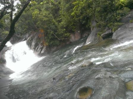
First stop about 30kms north of Innisfail is Josephine Falls, a large boulder tiered cascade in the heart of the thick, lush tropical rainforest. It’s a short walk in to the various lookout points and swimming areas – make sure you heed the signs, oh and plaster yourself with insect repellent too. 
Easy walking track to Josephine Falls
Josephine Falls
Swimming area at Josephine Falls
We enjoyed a cup of tea in the picnic area, which is located at the track head for the climb up to Mount Bartle Frere. It’s a difficult 15 km return walk to the summit, and given that the area averages 10-12 metres of rain annually, it’s most likely to be wet and slippery too. Between May and October are the best months to tackle this two day hike.


Travelling north we arrived at the picturesque town of Babinda then turned west to the town’s local swimming and picnic area. Before taking a dip in the designated spot, we warmed ourselves up with a 1.3km return stroll along the Devil’s Pool walking trail. The cool mountain water thunders down over enormous granite boulders and has carved out a gorge over thousands of years. 

Boulder Gorge


The 19 km Goldfield Track leaves from here which follows an old 1930’s mining trail over the saddle between Mount Bartle Frere and the state’s second highest peak, Mount Bellenden Ker (1593m). This walk can be done in a full day but you would need to arrange transport at the end.

A pity we weren’t travelling in Delvy as there is a free camping area near the Babinda Boulders. Something to bear in mind when we return in the dry season; along with everyone else I suppose!


Being New Year’s Eve it was time to head off to Cairns to spend the night with old friends at the beachside suburb of Yorkeys Knob. After a night of plentiful food and good company, I rose for an early morning walk along the beach before the long drive back home to Airlie Beach and the start of a new year.

Yorkeys Knob beach

Tuesday, 12 January 2016

Road trip Tropical North Queensland - Part 2 - Innisfail, Atherton Tablelands, Kurrimine Beach

At sunrise the next morning we were up in the air as there was a small break in the weather. What a joy it is to be like a bird and look down at the patchwork quilt landscape of rich red earth and bright green plantations of bananas, papaya and sugarcane. The mangrove lined river snakes its way to the Coral Sea, and the enormous art deco buildings of Innisfail are distinctive in the near distance.

Getting ready to fly the gyroplane at Innisfail Aerodrome
When the weather closed in, with touring map in hand we headed for the lower Atherton Tablelands along Palmerston Highway for a bit of a drive. Whilst the visibility was poor for views of the district, the waterfalls were in fine form. First things first though; morning tea at Mungalli Creek Biodynamic Dairy and Organic Cafe after our early start to the day. The scones were the best I have eaten - light and fluffy - and made all the more yummy with homemade butter and strawberry jam.

Making cheese at Mungalli Creek Dairy
Feeling recharged, we drove along the 15 kilometre waterfall circuit just up the road. After slathering ourselves with Bushman’s insect repellent, it was a rewarding short walk to the base of Ellinjaa Falls, whereas the Zillie Falls further up the road was viewed from above. The picturesque Milla Milla Falls is the most popular and perfect for a refreshing swim. Depending on how much water is flowing over the top, it’s possible to duck under the falls and sit in behind the curtain of water. It’s a most beautiful sight looking up underneath the falling water – the droplets are like stars raining down over the vertical carpet of ferns.
Ellinjaa Falls

Zillie Falls

Milla Milla Falls
Returning back down the tableland to Innisfail aerodrome it miraculously stopped raining for us to get an afternoon fly before heading to the Mena Creek Hotel for dinner.

The next day after another early morning fly, we headed for Kurrimine Beach, which according to the brochure is “a beachside haven where The Great Barrier Reef nearly touches the coastline”. Guided reef walks to nearby King Reef operate throughout the winter months, and if you have your own boat the Barnard Island Group and the dense rainforest of Dunk Island are only kilometres from shore.

Kurrimine Beach
Not a lot happens during the wet season - the place was like a ghost town whilst we were there – so we enjoyed a stroll alone along the lengthy beach. It coincided with the first time it had stopped raining since we arrived in the wet tropics.

Heading back out to the Bruce Highway we passed Murdering Point Winery but it was a little early in the day for us to taste the red and white tropical fruit wine on offer. The name is a point of interest though: the survivors from an 1878 shipwreck on Kurrimine Beach were not so lucky after all, having been murdered and eaten by local aborigines once they made it ashore.

We continued our day of sightseeing to Coquette Point for a view of where the South and North Johnstone Rivers converge. Once again the view was diminished due to the rain and associated cloud but we still enjoyed a cup of tea from the thermos whilst watching the rain fall on the windscreen of the Subaru.

Rain, rain, rain on the South Johnstone River
We headed back into Innisfail and crossed the river for a drive north to Flying Fish Point and a dirt road to the secluded and peaceful beach of Ella Bay. We passed a prawn farm along the way and at the end of the public road is a cassowary sanctuary on the former cattle property, which backs on to national park and the Wet Tropics World Heritage Area.  However, that is all about to change according to some locals we were chatting to that night, as a three-stage resort and residential development has been approved for the area. I wonder where the cassowaries will go then – their habitat continues to diminish putting their future at stake.

Ella Bay
Back to Roscoe's for a take away pizza to eat on our cabin balcony in amongst the rainforest at Paronella Park.

Relaxing on the balcony

Wednesday, 6 January 2016

Road trip Tropical North Queensland - Part 1- Ingham to Innisfail

It was time for some more gyro plane flying lessons, so last Monday we set off for the six hour drive from Airlie Beach in the Whitsundays to Innisfail. The weather forecast wasn't looking promising (200 mm of rain over the next three days!) but we had the time off so if we didn't get any flying hours we would relax and do some sightseeing around this relatively unfamiliar area.

Waterfalls were on the agenda, aptly so considering that the wet season had officially started in the Tropical North of Queensland. I wanted to see the longest permanent single-drop waterfall in Australia, near Ingham in the Girringun National Park. We stopped off at the information centre to get details of the drive out there as takes about an hour from the centre of town. Just as well we did. The helpful and informative staff advised us that it hadn't been raining enough yet to see the 267 metre waterfall in its entire splendour, and if we were passing through again it was best to wait. So, we’ll schedule that detour for further into the wet season in February or March.

Continuing through Ingham we left the Bruce Highway for Lucinda, via Halifax. We passed Victoria Mill, once one of the largest sugarcane mills in the southern hemisphere, with its three tall steam stacks clearly visible in the distance. From June to November, the mill crushes 3.74 million tonnes of sugarcane, and recycles its waste into energy and feeds power back into the electricity grid. The raw sugar produced is then transported by rail to the port village of Lucinda, home of the world’s longest offshore sugar loading facility with a 6 kilometre long jetty stretching out to sea.

Lucinda Jetty

Majestic Hinchinbrook Island looms in the background - Lucinda is the departure point for channel boat charters and access to the well-known Thorsborne Trail. The Palm Island Group is also nearby, which includes the luxury resort island of Orpheus.

Hinchinbrook Island

The sleepy main street of Halifax, once the hub of the Herbert River district, is lined with heritage listed mango trees and historic building facades. The smell of mango hangs heavy in the air at this time of year, as abundant fruit falls from the trees and ferments in the hot sun.
Herbert River

Mango madness

Looping back on to the highway the road climbs for some fantastic views of the Hinchinbrook Channel. There’s a lookout at the top – well worth the stop to take in this World Heritage Area if there is no cloud.

The day was getting on and we were keen to see if we could get some gyro plane flying in, so we continued north through the seaside town of Cardwell and onto Tully. A quick stop to climb the Golden Gumboot for a view of the town, its sugar mill and surrounding misty mountains was in order. At 7.9 metres high, the gumboot marks the record-breaking rainfall the town received in 1950 – well above the annual average of four metres.

The Golden Gumboot

Tully sugar mill


We moved on as it started raining, not surprisingly, turning off onto the Canecutters Drive for a more scenic route into Innisfail. This led us to Paronella Park and our accommodation for the next three nights. We were booked into a cute and cosy cabin backing onto dense lush rainforest this time instead of the campground, which worked out well as it pretty much didn't stop raining for the next three days. The nearby Mena Creek Falls were deafening (we could hear them from our cabin) as we hung out on the swing bridge watching the water thunder over the cliff.
 
Cabin accommodation at Paronella Park

View from swing bridge over Mena Creek Falls

Mena Creek Falls - view from inside Paronella Park
No flying that afternoon due to, you guessed it, the rain, so we celebrated our wedding anniversary at a local Innisfail restaurant, Roscoe's. Each evening they put on a splendid Italian buffet and it’s very difficult not to stuff yourself silly. A tip though; get there on opening at 5.30pm, or wait until after 7.30pm when the tour bus departs and it starts to quieten down. Alternatively, order takeaway pizza or pasta from the window at the front and enjoy very casual al fresco dining with a glass of something red from the bar.